Exercise 6 - Solutions
Import satpy first…
import satpy
- Read the Scene that you downloaded from the data directory using SatPy.
dateien = ["../path/to/file.nc"]
files = {'seviri_l1b_nc' : dateien}
scn = satpy.Scene(filenames=files)
- Load the composites “natural_color” and “convection”.
scn.load(["natural_color","convection"])
- Resample the fulldisk to the Dem. Rep. Kongo and its neighbours by defining your own area in Lambert Azimuthal Equal Area. Use the following settings:
- lat and lon of origin: -3/23
- width and height of the resulting domain: 500px
- projection x/y coordinates of lower left: -15E5
- projection x/y coordinates of upper right: 15E5
from pyresample.geometry import AreaDefinition

area_id = 'Dem. Rep. Kongo'
description = 'Dem. Rep. Kongo in Lambert Azimuthal Equal Area projection'
proj_id = 'Dem. Rep. Kongo'
proj_dict = {'proj': 'laea', 'lat_0': -3, 'lon_0': 23}
width = 500
height = 500
llx =  -15E5
lly =  -15E5
urx =  15E5
ury =  15E5
area_extent = (llx,lly,urx,ury)
area_def = AreaDefinition(area_id, proj_id, description, proj_dict, width, height, area_extent)
local_scn = scn.resample(area_def)
- Save both loaded composites of the resampled Scene as simple png images.
local_scn.save_datasets(writer='simple_image',
                  datasets=["natural_color","convection"],
                  filename='{name}_{start_time:%Y%m%d_%H%M%S}.png',
                  base_dir='path/to/output/folder')
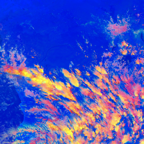
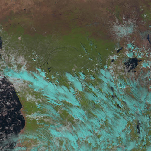
If you did everything right, the images should look like this:
local_scn.show("natural_color")
local_scn.show("convection")